
Super Typhoon Bavi is expected to spare South Korea a direct hit as it heads for Taiwan and China this week, though forecasters say it could still bring another round of monsoon rain across the country.
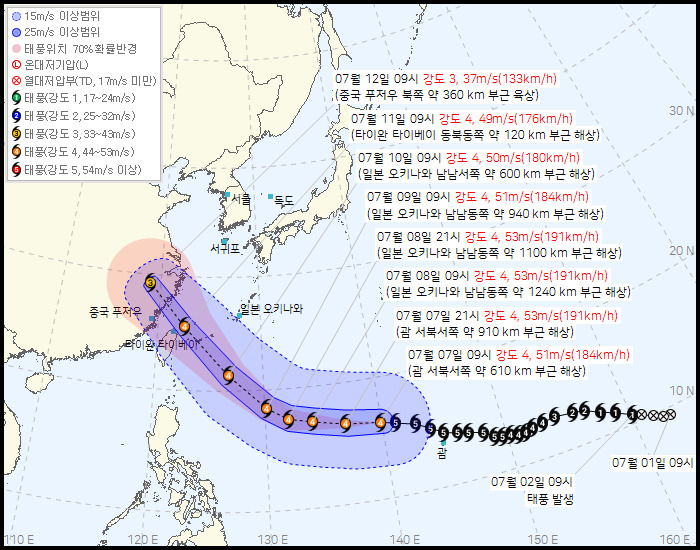
As of 9 a.m. Tuesday, the storm was about 610 kilometers (380 miles) west-northwest of Guam and moving west at 21 kilometers per hour (13 miles per hour), the Korea Meteorological Administration (KMA) said. It had a central pressure of 925 millibars and maximum winds of 51 meters (170 feet) per second, and was rated a Category 4 storm.
Bavi was previously labeled a Category 5 super typhoon on Monday, the top of the scale. It tore across the island of Rota in the Northern Mariana Islands and battered Saipan and Guam with heavy wind and rain.
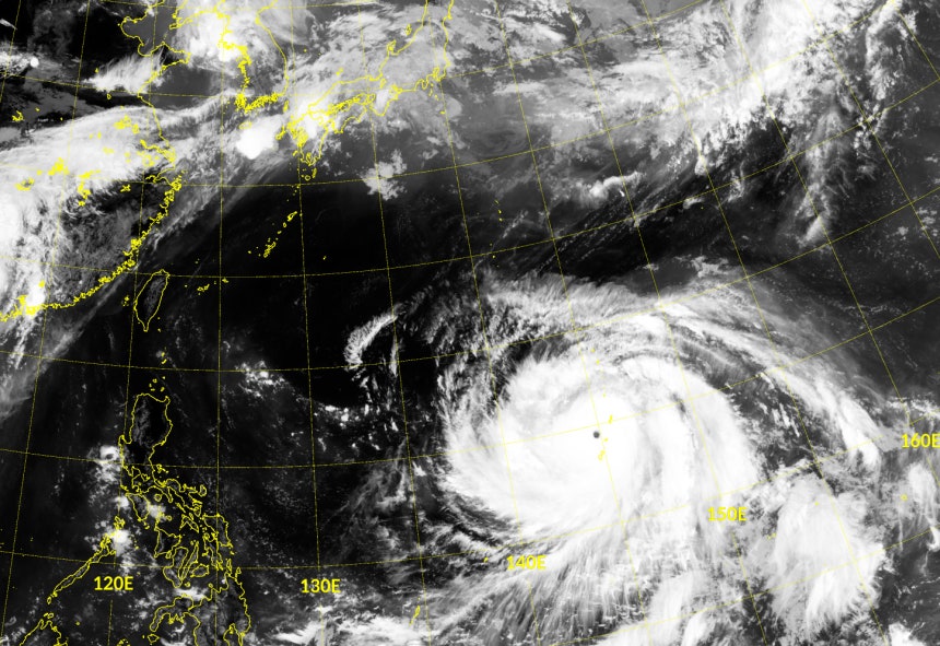
Bavi has weakened somewhat since Monday but remains powerful, its eye still clearly visible on satellite images.
"Bavi is moving along the edge of the North Pacific high," said Lee Gwang-yeon, a forecaster at the KMA. "Its eye is very well developed, and so are the spiral rainbands around it."
Bavi is then expected to turn to the northwest, pass north of Taiwan on Saturday and make landfall near Fuzhou, China, on Sunday. Even after coming ashore, it is forecast to hold Category 3 strength and bring strong winds and heavy rain to inland China.
With Bavi bound for China, forecasters do not expect it to directly affect South Korea. The moisture it leaves behind is also likely to be steered north of the Korean Peninsula, toward North Korea.
"High pressure has taken hold around South Korea, so for now, even the leftover moisture from the typhoon looks likely to follow the boundary of that high pressure toward North Korea," said Kang Nam-young, a geography professor at Kyungpook National University who specializes in typhoons.
Still, Bavi is strong enough to unsettle the pressure patterns around the peninsula. That could bring another round of nationwide monsoon rain to South Korea around July 15.
"The moisture from Bavi won't directly affect South Korea's weather, but the pressure system will realign once the storm dissipates," Lee said. "There is a chance of additional rain in the latter half of next week."