Visiting Greece

We just returned from a trip to Greece. Our visit to the country was loaded with many wonderful experiences. For some reason, this particular tour also seemed to be a more relaxed experience when compared to our earlier tours to other places – we spent extra night in towns, had more free time, later starts in the morning, etc… We had a good tour manager. Konstantina (Dina) Statha took care of us during our travels, educated us about her country, helped us experience the best of the country, and allowed us to have the time of our lives during the tour.

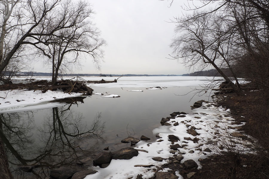
Greece is a beautiful and generally mountainous country, with greenery abounding. I enjoyed myself taking pictures out of the windows of the bus we were on. Aside from the highways, our travels took us on many narrow and winding roads, in a full sized bus, tackling switchbacks and roads that crossed high mountain ridges and passes. The main highways included many more tunnels than I expected, dug through the mountains. We had some excellent drivers for our buses who got us around safely – two Apostolos and one Taso – the later drivers taking care of us on the islands of Mykanos and Santorini.

The foods of Greece are also quite distinct in their nature. Due to the fertile nature of the soil there, there is an abundance of fruit and vegetable available. They also produce all of their meats, except for beef, locally. (We heard that there are only a few areas in the country where the cows can graze.) Salads full of huge slices of tomatoes, dips made of crushed eggplant (I think it is called Melitzano salad), and from crushed fava beans (with capers on top sometimes), were served on a few occasions. They have the dolmas, spanakopitas, and moussaka. Their regular food included dishes made of mushrooms and olives, two things that are not my favorites. I did not object to the eggplant!

We heard that they use herbs as their primary means of bringing flavor to dishes. (We heard that in countries further east, like Turkey, the use of spices is more common.) They have sweets and savory dishes that make use of Phylo dough for the base and covering. There is some similarity between their sweets and what one gets in neighboring Turkey. They also have their loukoumi (Turkish Delight) and halva, and something similar to baklava.

I have to admit that I usually ended up having gyros at meals when I had the choice. The gyro that I had in Kalambaka, and the circumstances under which I consumed it, stand out in my mind – the taste, the location, the human interactions, etc..

We were told that agriculture, tourism, and shipping, are the three legs of the Greek economy, and that they have no heavy industry,

We learnt about the history and mythology associated with Greece. The country is considered the cradle of Western Civilization. Greek mythology is taught in elementary school in Greece.

We heard that the boundary between mythology and history is not well defined in Greece. In their mythology, the first things to exist were the holy trinity – Gaia (Mother Earth), nothingness (the great void) and love (Eros). Next came the Titans. We heard the story of how the twelve gods of Olympus came to be. The Gods used to live on Mt. Olympus. (The mountain is a natural park today.) From the 8th century BC, the philosophers noted that it was OK for people to question mythology. The gods took on human characteristics, including their faults. Zeus in particular turns out to be a womanizing scoundrel with a few illegitimate progeny, including Apollo and Dionysus.

We visited a few places known for their ancient ruins, some even dating back to the 3rd Millenium BC, with signs of settlements going as far back as the 6th Millenium BC. A few of the more recent ruins that we visited used to be places dedicated to the worship of Greek Gods. There are also later ruins from when the Romans invaded the country. We heard about other invasions – by the Persians (before the Romans), the Byzantine Empire, the more recent conquest (a long one!) by the Ottoman Empire, and then the occupation by the Nazis during WWII.

Greece was historically called Hellas. It is also called the Hellenic Republic today. We were told that Homer brought the name into common usage in the 8th Century BC.  We also heard that Homer also introduced a common language for the region during his time.

We learnt a lot about the people – generally easygoing, open to conversations (if they spoke English!), and flexible, not as pushy as in some other places, and often willing to do you a favor without a second thought. Some of the smaller towns that were not as overwhelmed by the tourists turned out to be the more charming. The smaller town centers many a time featured a relaxed outdoor setting where people could hang out. I noticed both men and women hanging out in the middle of the day. In one of the towns we saw young children in strollers out in the park at 9:00pm at night!

BERJAYA
BERJAYA
BERJAYAFood was actually inexpensive in the smaller towns. The only discomfort was from the fact that people smoke openly in these places. I am not used to this.

Most of the Greeks are Christians who follow the Greek Orthodox Church. Their churches and chapels are primarily influenced by the Byzantine architecture, and include distinctive domes, most of the time blue in color.

We heard about the colors of Greece and the nature of their flag. The design of the flag is connected with the Greek revolution in the 19th century, when they got their freedom from the Ottomans. (When the Kingdom of Greece was established in 1832, the first ruler who was installed was from Germany. His name was Otto!) The color white in the flag represents the purity of their cause, and the cross represents their religion. Blue appears to be a color used historically in old flags of the country. The nine blue and white stripes are noted by some people to stand for the nine syllables in the motto “freedom or death” in the Greek alphabet.

Greece became a part of the EU in 1981. They started using the Euro as their currency in 2002.  They have been a parliamentary republic since 1974.  The Presidential position is ceremonial. The prime Minister leads the government. The current prime minister’s first name is very similar to mine in spelling. I brought this up during the first days of our travel a couple of times, and there was a very negative reaction to it. Apparently he is not popular. The internal politics of Greece did not come up again during the rest of the trip!

We started our travels in Tessaloniki, in the region of Macedonia (called Macedon in historic times) in the northeast. This place seems to be have been the most influenced by the foreign invaders from the east – Byzantine and Ottoman. We first drove up the hill that dominates the city to see the walls of the fortress of Tessaloniki.BERJAYAThese walls changed shape over the years of occupation by the different invaders, and the evidence can be seen in the nature of the walls themselves.BERJAYAWe were told that the fort is notorious for having been a prison called Yedikule. We heard that people, including juveniles during a more recent period of time, were housed there under inhumane conditions even up to its closing in the 1980s. There are supposed to have been songs written about the place in the 1970s. I have not been able to find outside confirmation about some of the assertions.

We then drove down to the main part of town to explore on foot. One can just hang out in the streets with the locals and other tourists, and also explore the historical sights while you are about it. These include Roman, Byzantine and Ottoman ruins and buildings, and also, most surprisingly, a museum dedicated to Attaturk, the architect of modern day Turkey. Apparently, he was from Tessaloniki.

We visited a few markets in town during our morning walk as a group. We were introduced to Greek coffee (similar in some ways to Turkish coffee), the nature of olive oils, and also different herbs of the region. We sampled distinct foods of the region, including the bougatsa pastry. We hung out at Aristotelous Square on our own after lunch, and then took a walk to the Church of St. Demetrios. The tour company, Gate1, had organized our first group dinner in the Ladadica district of town at the end of our first full day in Greece.

The next day, we traveled westward, passing through the towns of Veria and Vergina. Veria was one of the towns where St. Paul preached during one of his visits to Greece, in the process of bringing Christianity to Europe. There is a memorial at the location where he is supposed to have addressed the people of the area. The podium is called the Bema.BERJAYAThere are actually tours organized for pilgrims to follow in the footsteps of St. Paul through Greece.BERJAYA

Veria is the place in Greece where the Jewish people who were escaping persecution in Portugal and Spain in the 16th Century came to settle down in. The town has a lot of connection to Jewish history. Most of the Jewish population of Veria was forcibly deported to concentration camps outside of the country by the Nazis during WWII. Many Jews of the village were saved by locals. (Fake baptism certificates were even given out by the church in some cases.)  The synagogue has been restored since that time.BERJAYAA few of the Jews who left Veria as a consequence of WWII came back in later years to rekindle their connection with the people who helped them.

Our next stop was Vergina, which is located close to Veria. It was in an area near present day Vergina where archeologists found the former capital city of Macedonia, and close to it, the burial site of King Philip II, the father of Alexander the Great. Philip II was responsible for bringing different parts of Greece under a single rule. Manolis Andronikos was the archeologist who finally discovered the tomb in the 1970s, under a mound called the Great Tumulus.BERJAYAWe visited the museum that is located under the mound. One can visit the tomb of Philip II.BERJAYA

This was the first of the many museums that we went to during our trip. I am personally not particularly enamored of these kinds of visits since there is potentially too much information to be consumed in too short a time. But Dina did a great job capturing the significant things from these visits that she felt were worthwhile noting, and showing us the museum pieces in this regard, so that we could make the best use of our time. Some of the sculptures in these museums are amazing. I took a picture of the display shown below at the museum just because I liked how it looked!BERJAYA

We proceeded further east, and in a generally southward direction, to the town of Kalambaka, in the region of Meteora. We spent two nights in Kalambaka. We crossed into the regions of the Pindus mountains on our way. As we approached the town, we left the highway and descended into a valley . We crossed a pretty river and ascended the other side of the valley.  We were on winding mountain roads with greenery all around and verdant valleys below. This is a region of remarkable geological formations, with towering pillars of rock rising from the canyon floors. We were told that this was the most beautiful section of the drive.

After a short drive in a valley beside a mostly dry river bed, we arrived at the town of Kalambaka.

The hills of Meteora formed a spectacular background for our hotelBERJAYAbut our room was on the other side of hotel! 

This area used to be a sea in prehistoric times, and the structures have been formed as a result of erosion. This is an area of ancient monasteries that have been built on the top of cliffs. The story of how this came to be is very interesting. These were originally places where the ascetics, starting in the 11th century, went to get away from people and meditate on their own. The monasteries came into existence in the 13th century. Only six of the more than twenty-four original monasteries remain. This is only the second biggest community of monasteries in Greece. The biggest one is in Athos.

The picture below, taken from a viewpoint, includes a a majority of the monasteries.BERJAYAWe went on to visit one of these monasteries – the Holy Monastery of St. Stephan.BERJAYAThis particular monastery was actually converted into a nunnery in the 1950s. There are nine nuns left. (Some facts learnt: In order to become a monk, one has to be 18 years old, take a vow of poverty, and also take a vow of Chastity. Interestingly, one does not have to be a priest to be a monk. Also, today, the government plays a role in the running of the remaining monasteries.)

During the stay in this area, we also went black truffle hunting in the woods with Benfra, the truffle hunting dog. The breed of dog is Lagotto Romagnolo. It is an Italian breed. There was a lunch prepared in the woods that made use of some of the truffle that had been found. Unfortunately, it was a pasta made with tons of butter and a load of other another kind of mushroom.BERJAYAThe white truffle is rarer and more expensive than the black truffle.

We also visited a local vineyard.BERJAYAThe claim is that even though the worldwide consumption of Greek wines (meaning they are produced from Greek varieties of grapes) is a new phenomenon that only started around the year 2010, they are already of world renown quality.

We visited a museum of Natural History in Kalambaka.BERJAYAThe museum included stuffed animals and birds from all over the world. We also went to the attached museum dedicated to mushrooms. We learnt about the history of the use of mushrooms, and also learned about the different kinds of mushrooms. We ended up buying truffle chocolate from the museum store. I will readily admit that I am not very fond of them.

Our travels then took us south and onward to the small village of Nafpaktos. It was a cute little place whose population is supposed to be about 60,000.  It is off the beaten path and gets less tourists. We stayed in a small boutique hotel. The place had a very different feel from Kalambaka. A unique Venetian Castle on a hill overlooking the town dominated the view on the one side of town,BERJAYAand the waters of the Gulf of Corinth of the Ionian Sea lay on its other side. Across the water we could see the hills and mountains of the Peloponnesian peninsula.BERJAYAIt was only during our second evening in town that we discovered the town center of Nafpaktos, with its lively square surrounded by coffee shops, eateries, and stores for tourists. I actually think it would be good fun to hang out in small towns like this for a while and explore the local space. I, unfortunately, did not get a chance to climb the hill up to the castle.

We used Nafpaktos as a base for a visit to Olympia, the site of the ancient Olympic Games, believed to have been first held in 776 BC. We first visited a museum at this location.BERJAYA We then explored the ruins of the site of the Olympic Games itself. Among the things we saw were the ruins of the Temple of Hera and the stadium.Ruins of the Temple of Hera
BERJAYAWe also saw the ruins of the Temple of Zeus, the area of the Gymnasium, the Palestra, etc., We heard the stories of these Olympics – about how they came to be, and about the nature of these proceedings. The games were initially conducted as a religious activity, held once every four years, and it was a high honor for athletes to participate in them. The participants competed in the nude. Slaves, women, and foreigners were not allowed to participate. (We did hear the story of a woman who broke that rule.) Records show that there used to be a Heraean Games, also conducted once every four years in Olympia, just for women.

The history of the place came alive as we listened to the circumstances and stories of the Olympics. The games were abolished in 393 AD, after Christianity was established in the country, since games were considered to be a pagan event. The modern Olympics were only revived in 1896.

On our way back from Olympia to Nafpaktos, we stopped at a restaurant where we also got some cooking lessons from the chef, and then a lesson in the Greek style of dancing. We did eat some of the food that folks in our group had worked on.BERJAYAThe dancing culminated in some dance lessons.BERJAYA It included some dancing on the tables towards the end, and some breaking of plates on the floor! I think the only musical number being played in the background for the entire duration was a certain section from the theme for the movie Zorba the Greek. The steps appeared to be simple, but, unfortunately, like me, I think there were other folks also who had trouble identifying their left from their right in the heat of the moment. Our dance teachers danced for us on their own towards the end – to show us how it was really supposed to be done!

From Nafpaktos we moved on to Athens in the east, with a stop in Delphi along the way. The ruins of Delphi, spread out over the southwestern slope of Mount Parnassus, were impressive. This is a view of the ruins of the Temple of Apollo, with the valley below.BERJAYAThe ancient Greeks considered Delphi to be the center of the world. It was a holy place dedicated to Apollo. There is a story told, a myth, about how Apollo came to Delphi.

Delphi was the seat of the Oracle of Delphi, also called Pythia, the greatest and oldest oracle in Greece. The oracle was consulted about important decisions throughout the ancient classical world. Major events, like wars, only started after consulting with her.  She handled questions from all kinds of people, not just from the powerful entities. The questions were passed to the oracle by the priest. The gods spoke through the prophetess.  The answer was then interpreted by the priest and passed on back to the person who originated the question.  Apparently, the answers became more and more vague and subject to different kinds of interpretations as time passed. The prophesies of the oracles become less respected with time. We heard that one was obligated to follow instructions given by an oracle. I am not sure what the consequences were of not listening to the oracle.

They used to conduct the Pythian games in Delphi once every four years, just like the games at Olympia. One aspect of the ruins that I found impressive was that the stadium was located at the top of the mountain. We did not have the time to climb that far up the hillside.

We did make a visit to a museum that is at the site before we visited the ruins themselves. This is the Sphinx of Naxos seen in the museum.BERJAYADina spoke to us about the evolution of the Greek style of sculpture, with the heavy influence of the Egyptian style in its initial days. The Greeks sculptures became more realistic in their depiction of human beings in their natural poses. The sculpture of the Charioteer of Delphi is the most impressive in this context. One can even see the vein in his arm.

And then it was on to Athens. My knowledge about the city of Athens was limited primarily by its place in history – with the classic image of the ruins of the Acropolis, with the Parthenon atop the hill dominating the surroundings, stuck in my mind. It turns out that Athens is also a great cosmopolitan city to hang out in and explore on foot. Also interesting to experience there was the fact that there are random ruins scattered all over the place, in the midst of all the typical 21st century street activity. There are crowds on the street, most of them younger people, enjoying the ambiance of the place. We had enough time to explore a little bit on our own, including a visit to the tomb of the unknown soldier, and the bustling Markapolis Square.

During our stay in Athens, we visited the Acropolis, and also the Acropolis museum – where we saw some of the pieces that have been discovered by archeologists in the area. We were made aware of the fact that the British “looted” the excavation site to take many important pieces – like one of the massive caryatids and the whole western pediment of the Parthenon – back with them to display at the British Museum. The truth of the matter is that the British have done many such misdeeds in other parts of the world also. The pieces from the Acropolis have not been returned up to this day. I believe the Greeks are unhappy about this!

We walked up Philopappos Hill later in the day on our own, to get a view of the Acropolis in the evening light. That was a highlight for me from our stay in the city.BERJAYA

From Athens we took a high speed ferry to the island of Mykanos, and then on to Santorini, The islands are part of the Cyclades. (About 33 of the approximately 220 islands are inhabited.) We enjoyed the ride itself, but not the embarkation and disembarkation processes. It seemed that the ferry operators are intent on lowering their turnaround times at intermediate ports to a minimum. These massive ferry ships process a whole lot of people and vehicles in a very short amount of time when they get into port. The process is chaotic, and it was amazing that not one of us lost our luggage in the process. It must be hell for older people, and surprisingly people were not hurt.

Mykanos island was a bit of a disappointment. We heard that the island only began to be recognized as a place to holiday in since the 1970s, when celebrities like Aristotle Onassis went there to try to escape from the paparazzi. To me, the town of Mykanos was basically a place for people to hang around in – to relax, shop, and to eat and drink and be merry. The vibe I was getting from the place did not draw me in. It did not seem “charming”. There was a sorry excuse for a beach. I did get a few nice pictures at sunset. It could be that our introduction to the place was sub-optimal, and that we did not get enough time to explore the surrounding area. It was also a disappointment to find out that folks in some of the establishments did not seem to mind taking advantage of tourists.

The most significant issue with Mykanos Island in my mind was that there was limited scope for us to explore outside of the town itself. The roads around the island that we drove on were narrow and in bad shape, with no place for walkers. We had no reason to believe that things would be better elsewhere on the island. We were also not aware of anything else that was worthwhile to try to experience on the island. The roads were such that there were spaces where two vehicles could not pass each other, and one or the other had to back up to a wider section of the road to let the other one get by. It was mostly the cars that did the backing up and giving way, but our bus was also forced to do this on at least one occasion.

The highlight of the stop in Mykanos was our visit from that island to the island of Delos to see the ruins there. The island is considered the birthplace of Apollo. (Apollo was born of one of the affairs that Zeus had. His mother had to flee to escape Zeus’ wife, Hera’s, fury.) Delos was first a pilgrimage site for the Greeks, but later became a significant seaport commerce town for the Romans. It was supposed to have been a very cosmopolitan place, with people from all over the world residing there. People were allowed to practice their own religions. Delos was destroyed because of conflicts and because of the loss of its position as a commercial center. The island was never repopulated. A story we were told is that the authorities also did not allow people to give birth on the island. This might have impacted the connections that the locals felt with the island itself.

Besides, the island did not seem to be a very habitable place. There seemed to be no protection from the hot sun, and water needed for daily use had to be collected in the underground cisterns when it rained. It seemed to be a very dry space. Regardless, the place thrived during its heyday. The ruins of the town are amazing to walk through. We did see the lions of Delos who are protecting the area where Apollo was born. We also visited the museum.

The setting for the island of Santorini is quite spectacular. It is in the shape of a crescent, and the island, along with a second one called Therasia, mark the edge of a caldera belonging to an ancient volcano. The view of the caldera from a trail that runs along a ridge from Fira to Oia is spectacular. From some vantage points, you can seen the entire breadth of the caldera. One can see cruise ships docked at the bottom of a massive cliff just outside of the town of Fira. People are unloaded onto boats to take a cable car up to the town.

Our hotel was on a ridgetop just outside of Fira. That location allowed us to get views of both sides of the island without doing too much walking! This was a sunrise.BERJAYAI was not in a position to get a picture of the sunset while on Santorini.

There were a couple of highlights for me of our visit to Santorini (also called Thira, or Thera). The first was a visit to the ruins of Akrotiki. It is an amazing place. The story behind the discovery of the ruins in 1968 by Spyridon Marinatos, is interesting. The ruins are protected by a massive building that covers the space. The recent version of the building was only completed in 2010.BERJAYAThis building replaced an earlier one that actually collapsed on to the ruins. Earliest habitation at this site traced to the 5th Millenium BC. There was significant expansion by the 3rd Millenium BC. It shows how organized its society and its people were at that time. It was a very egalitarian society, seemingly much better in this aspect of life than our current society. The city was remarkable in its town planning and layout, and structure of the homes. They even had a sewage system. All people lived in similar sized homes and no ones’ home was bigger and more ostentatious than the others’. There was no palace. Their technology allowed the two-story homes to have some protection from the earthquakes that were common there. We heard that the people left gradually as the intensity of the earthquakes in the region began to increase. Santorini had a major earthquake in the 16th century BC that destroyed Akrotiki.

My second highlight of the visit to Santorini was a hike that we did on our own to Skaros Rock on the second day, a day that we had to ourselves. We departed the hotel before 9am, when most people had still not gotten out. We walked on the trail that goes between Fira and Oia to the village of Imerovigli. We navigated the narrow pathways between the buildings of Imerovigli, up and down slopes and stairways, on the side of the hill on which the town is located. Boutique hotels, rentals (some even with small swimming pools), and restaurants, lined the narrow path. We emerged from the maze of pathways in the town into an open-air stairway, to descend to the base of Skaros Rock. And then we were climbing again – up the rock. It was a tough walk, but it did offer spectacular views of the caldera all through it. We could see the white towns with their Canava cave homes along the inner wall of the caldera, including Oia, in the distance. Cruise ships sat in the water below us, underneath the town of Fira.  Small catamaran party boats sat in the water. The surprise that we got was the church that sat at the bottom of Skaros rock, on its other side, only visible when one walked around to the back of the rock. The white and blue colors grabbed ones attention.  I made it to the church!

The display at the base of Skaros Rock indicates that there was a temple to Athena at this location in the 5th century BC. Skaros Rock was also the location for an early settlement and a castle built by the Venetians. The ruins of some of the old buildings can still be seen on the rock today. I was able to get a nice picture of the town of Oia in the distance from this location.

Santorini is a much more developed place than Mykanos. It is also known for it wine, and the unique wreath-like form in which the base of the plants are made to grow – to protect them, and the grapes, from the elements, and to optimize the availability and intake of water from the wind and the soil. The form of the vine is called the Kouloura. We were told that there was no irrigation, but that could be a traditional thing. It can take about 90 years for the base of the plant to mature in its final shape. You would not recognize that you were passing a vineyard at first glance.BERJAYAThey primarily grow grapes of a local variety. Most wines from Santorini are white. Wines are acidic due to the soil and weather. 

I enjoyed Santorini a lot, but our visit to the town of Oia on the island was a total disappointment. Apparently the thing to do in Oia is to experience the sunset, and also visit some particular viewpoints in town. Unfortunately everybody else in the massive crowd that we found ourselves in had the same idea. We gave up the effort and went to a restaurant for dinner. I opted for a cocktail with a double dose of alcohol to help me get my spirits back up again! I did manage to get a nice picture after sunset, after the crowds had dissipated.BERJAYA

Our visits culminated in a farewell dinner where we enjoyed the company of friends we had made during the trip. From our previous trips to other countries, I am quite aware that the connections that have been made during these trips in most cases have a limited lifetime. The experiences are to be appreciated and remembered nonetheless.

We took an early morning flight from Santorini to Athens the next day, and headed back home from there.

I took plenty of pictures during the trip. The complete story of our travels can only be fully told via these pictures, very few of which I am able to post here. I am still in the process of posting more of them online in my picture galleries here.

That Peaceful Feeling

The last weekend was not the most relaxed, and perhaps not the best for ensuring a state of mind conducive to lower overall stress levels. But time does make the difference. Patience and recognition of that fact of life helps.

The saving grace from the weekend was that we were able to do our long Sunday walk. I can come back to enjoy the images that I captured from that outing every once in a while, to bring back a sense of serenity, even if it may be only temporary.

Spring is underway on the canal, and the beauty can be further celebrated if one immerses oneself in the little details.

It was a cloudy morning, with continuously changing weather conditions on the trail, cloud cover most of the time, with the chill of a cool breeze brushing our faces – with the clouds occasionally parting to let in the sunlight and reveal a little bit of the blue sky beyond – with a promise of some more warmth in the air soon.

The first introduction to the denizens of the area around Edwards Ferry were the Goldfinches. It was a thrill to see them and experience their intense yellow color, even though they kept their distance and I could not get a decent picture. I was hoping for better luck taking a picture of a Goldfinch on the way back from our walk, but they were gone by then.

I was in the mood to capture these kinds of pictures by the time we departed the parking area at Edwards Ferry.

The buttercups on the side of the lock definitely added a touch of color.BERJAYA

Fleabanes were beginning to make their presence known.BERJAYA These plants are apparently a kind of daisy.

We had a few sightings of woodpeckers. The picture below was difficult to capture because of our distance from the bird, and also the nature of the light. That is probably a red-bellied woodpecker.BERJAYA

There were a few clusters of flowering Dames Rocket plants. Some of the plants did not appear to be fully mature. Apparently, the plant belongs to the mustard family.BERJAYAThere were also some clumps of wild phlox flowers in the same general area. We studied the differences between these two plants on the fly using the smartphone – since the flowers look somewhat similar at first glance to a casual viewer. It was good for me to see that some of my recollections in this regard, having studied this topic in the past, were are actually correct and not a figment of my imagination. My ability to remember things is not what it used to be.

The Virgina Waterleaf (also called the Eastern Waterleaf) was tricky to spot. There were very few of these flowers, and closer to the ground. Luckily, I had my eyes peeled.BERJAYA

The Gill-over-the-ground (or Creeping Charlie) flowers were also very small and difficult to spot. The plants are all over the place, but they have not flowered in large volume as yet.BERJAYA

The leaves of the Virginia Bluebell plant were the only ones on which the morning dew appeared to have collected. They caught our attention.BERJAYA

There were plenty of young paw paw trees, and one could occasionally spot one of their flowers.BERJAYAUnfortunately, some of these trees, and some others, had leaves on the tips of some of their branches that appeared to be dying. I suspect it was the result of the recent frost that hit our area. (It affected the local vineyards very badly. It appears to have also impacted some shrubs in our front yard.)

There were plenty of noisy squirrels around. Sometimes it was difficult to differentiate their sounds from those of the birds.BERJAYA

Then there was the first zebra swallowtail butterfly of the season that we were sighting. (We might have seen the tiger swallowtail on a different occasion this season, on a different day.)

There were garlic mustard plants beside the trail in large numbers. They are just beginning to flower. This massively invasive plant will soon take over vast areas of the woods when they are in full bloom later in the season. We did see some grasses in the same area that I hope will survive the infestation. I heard that garlic mustard plants emerge only once every couple of years.

The white violet flowers closer to the ground were distinctive because of their shape, but there were not many of them. The honeysuckle were also beginning to bloom. There were sightings of Mayapple in a couple of places. There were plenty of Rosa Multiflora plants all over the place that have not yet begun to flower. We even saw a few Queen Anne Lace seed pods in the open area under the power lines. All in all, it was a good morning for exploring our surroundings and enjoying nature, and creating tranquility of mind.

There is a term used in photography the describes that nature of some of my pictures above. They are said to have a pleasant bokeh. The zoom lens that I was using, and the lighting conditions around us, contributed to this effect.

We have just seen a documentary about Henry David Thoreau and heard about the manner in which he tried to experience the natural world around him and take away some life lessons. I have just borrowed his book, Walden Pond, from the library.

We are headed out to Greece on Sunday for a vacation. Looking forward to experiencing some of the history of the country.

Vinyl

It was the month of August in the year 2025. It was the first trip I was making to Chennai after Dad’s passing. The primary motivation for the trip was to organize and participate in a gathering of people coming together in his memory. The gathering had been inspired by all the messages that we had been receiving after his passing. He had left an impression on a lot of people of various backgrounds, and I felt that there was a good reason for people to come together to talk about their interactions with him, and the impact he had had on their lives.

That trip was also the first opportunity for me to take a good look at what dad had left behind in the house, primarily in his bedroom, after his passing. It was an old and dusty space with lots of stuff, most of which had been left untouched for a very long time. The room had not had the advantage of a decent cleaning in recent times. And dad had moved into a different room in the house towards the end.

There were plenty of books that he had saved, even as the subject of a lot of them began to become less relevant, and even irrelevant, with the passage of the years. There were old magazines. There were old picture books from his travels in his younger days. There was this newspaper clipping of an interview that he had given during our family’s days in Hartford, CT, in the early 1960s.

There were utility bills in the drawers of his desk, some as old as 20 to 30 years, from the time that mom and dad had first moved into the house in Madipakkam. Some of these bills were remarkably well organized, using an approach that made sense even many years later, but whose contents were not really needed today, especially with the advent of computers and the Internet. There was the sense that dad felt that one could never know if and when the stuff that one was saving could become useful. Or perhaps dad simply forgot what he had saved and did not keep track after some time. There is a lesson somewhere in there for me!

There were all kinds of mementos, important only to him. There was the box of old and rusted tools of many kinds, most unusable. There were plastic and paper envelopes and folders that he had collected over many years, thinking that they could be reused and would become useful some day. Towards the end, he had even expressed an interest in giving some of this away to other people to use. The plastic covers in particular had become completely brittle and were falling apart by then, but he still did not want me dispose of them in the trash.

The typed sheets of paper that I found in his document collection, some from as early as the 1960s, were all brittle and discolored, and falling apart. He had written a lot. He liked to espouse his views on the topics of his times, the most significant of which was the subject of Catholic life and education in Indian society, where Hinduism was the religion practiced by the majority. He also wrote and published technical papers, most focusing on the topic of Catalysis, his specialty. He used to prepare some of his talks on the various topics he was involved in by writing on the backs of documents that he had received from others which had text printed only on one side. Multiple carbon copies existed of some of the documents that he had typed up on his typewriter.

There were random notes on little pieces of paper in the drawers of his table, and random pictures from the old times in random spaces. I discovered a few old letters, and some notes that he had perhaps written to himself. I realized that he had been a complex person in many ways.

My brother and sister, and I, have managed to get through the process of sorting out most of dad’s stuff, and disposing of most of it . This has happened over a period of time. I might have been the most reluctant among the three of us to get rid of some of the material. And I did save some random stuff, some of it probably to be disposed during my next trip to Chennai. It is a process for me.

But I have gotten sidetracked and forgot that I really wanted to talk about vinyl….

I do not remember if I have talked in the past about the role that music played in my life during the formative days of my youth. I have talked about how my collection of records of western music came to be. But even before that time I used to listen to what we called “western music” that played on the shortwave radio stations from Radio Ceylon (Sri Lanka Broadcasting Corporation), Radio Australia (on two radio frequencies!), and the Voice of America, and even on the local FM Doordarshan channel late on Saturday evenings after we returned from a screening of the weekly English movie at the Open Air Theatre (OAT). Mom used to listen to music from Hindi movies regularly during the day, sometimes singing in the background to herself. She instilled her love of music in all of her children.

Prior to dad’s passing, I had not known what had happened to the collection of vinyl records that I had left behind in Chennai when I left for the US in 1980. I had not seen them anywhere in the house in Madipakkam during my trips to Chennai in the years that followed. Nothing had been mentioned about the records in the time between. I had actually thought that they had been gotten rid of. But I had a surprise coming. Dad had actually saved the records in a little storage space above the almirah in his room. Wow!

I found myself excitedly going through my old collection of vinyl records. Many of the album jackets were falling apart. Record sleeves were also in a bad state, but the records themselves seemed to have maintained their original shape and shine. There were also records saved there that were from even before my time, records that could be played only on older players that supported speeds of 45 and 78 RPM (revolutions per minute). These records were smaller in size than the standard LP (Long Play) records of today that rotate at 33 ⅓ RPM, records that were capable of storing an entire album of up to 45 minutes with pristine quality (around 22 minutes worth on each side). There used to exist the concept of music albums recorded on multiple records. “Double albums” that came with two separate vinyl records in a single folded album cover became common. One of my favorite double albums from those days used to be Stevie Wonder’s “Songs in the Key of life“.

And then there were the country music albums that, for some reason or the other, I felt compelled to buy after listening to them at the record store. I did NOT get quite drawn to Western Classical music or Jazz at that time. That only happened later in life.

Seeing these old albums for the first time after so many years brought back so many memories. But I was also left with the question of what I wanted to do with all of these records. My brother and sister were not interested in any of this, and I was not about to bring the records back to the US. I made a half-hearted attempt to find out if there was any way for me to dispose of the collection in a useful way in Chennai itself. I was hoping that there were other people/organizations who might be interested in classic rock-and-roll records. I was not successful in finding any takers.

I am sorry to say that nostalgia and sentimentality only went so far. Ultimately, I got rid of most of the records. (I feel bad just thinking about all of this at this moment.) I took a picture of some of the album covers, and saved just a few of the records on a shelf in the new house in Madipakkam for old times sake, perhaps to also be disposed of during one of my future trips. Life will go on. And after my generation passes, the newer generations will not even know what I am talking about in this blog.

I am not getting rid of my current record collection in Gaithersburg any time soon. My family might have to find a way to take care of my vinyl, cassette tape, and CD collections after I am gone if I do not take some action in this regard before that event. And they will have to also deal with all the other “junk” that I happen to leave behind. I am hoping that digital junk is easier to deal with than paper junk.

P.S. Today also happens to be dad’s first death anniversary.

The First Sunday of Spring 2026

I told myself on Sunday that I should try hard not to lose the moment. Every time I come back from the Sunday walk, I have things I want to talk about, and ideas that I want to express, but I get caught up in the “other stuff”, and the mood is gone very soon. I started this blog on Sunday, and then I lost my motivation completely. I was able to get back to it only four days later!

Sunday morning did not start well for me. There were reminders (via text messages) that I woke up to that were troubling – of the cruel war in the Mideast, a conflagration lit up by our cruel and self-serving president and his continuing partner in crime from that region. (I have many more adjectives that I could use to describe these characters, but I do not want to start!) This evil couple have let loose the dogs of war. The gates of hell have been opened. Needless and seemingly unending chaos, death, and destruction, have ensued, especially for the already suffering people of the nation of Iran.

Our drive to Whites Ferry that morning did not calm me down. I was pursued down the highway, and on the local roads, by speedsters in a hurry, a couple of whom overtook me in a dangerous way in a section of the road with a very low speed limit, where one was actually not allowed to overtake, and another who followed me closely for a few more miles after that – before he or she found a way to overtake legally and speed away from us. What was the hurry on a nice Sunday morning, the first after the arrival of Spring? And why does one need to hassle others unnecessarily?

But the walk that morning did eventually get me into the good head space. We were greeted by the sound of birds as we entered the trail. We identified them using Merlin on the smartphone. There were cardinals, wrens, titmice, robins and even song sparrows. We actually saw only one or two of the birds in spite of the fact that the trees are still almost completely bare. It would be nice to learn the sounds of the individual birds ourselves. But I think that is highly unlikely to happen!

The gnarly, twisted, trunks of the bare Sycamore trees across the river caught my attention in the early morning light as we made our way west and north. BERJAYAAnd a little measure of calmness returned….

And new growth is also on the way in the woods.BERJAYAWe first sighted some Dutchman’s Breeches and the beginnings of the Virginia Bluebells. BERJAYA
BERJAYAThere was also a solitary Bloodroot flower that was opening out early in the morning.BERJAYAI was actually not too sure of the identity of this flower at that time. That Bloodroot flower, and many others, had all fully opened up a couple of hours later when we were on our way back to Whites Ferry. That was an amazing transformation in a relatively short time!BERJAYAWe also sighted some Spring Glory later during the walk.BERJAYA

I did not take any pictures of the Speedwell that we saw. We are beginning to use the technology available to us these days to identify these flowers on the fly, without having to take pictures and analyze them later after coming home.

And then there were the eagles. There is the spot a couple of miles north of White Ferry where we knew that they nested – on a Sycamore tree on the other side the river. We first saw the nest in the the distance.BERJAYAWe were fortunate to actually also catch sight of the couple.BERJAYAThe young ones should be coming soon!

Mergansers appeared occasionally on the river, mostly in pairs.BERJAYAThey would sometimes make efforts to get away – when they realized they were being observed, even if it was from a great distance. I took pleasure in simply seeing them take off and fly away over the water.

The Eastern-tailed Blue butterflies that made their appearance were amazing. They appear to be the first butterflies of the season. They are tiny, and they look blue while flying. But one does not see the blue color most of the time when they are still, the only time you are able to take their pictures. BERJAYAIt takes a lot of patience to get yourself in a position where you can see their blue when they are stationary. You may have to follow the butterfly as it flies around. And sometimes you could get lucky.
BERJAYA

The turtles were out, in families it seemed, sitting on the logs over the water.BERJAYAMany of them just dived into the water when they sighted us.

We could hear the woodpeckers all over the place but seldom saw them. I only managed to get this picture of a Red-bellied woodpecker.BERJAYA

We did encounter people on foot and on bikes who were also generally in a good mood because of the weather.BERJAYAIt turned out to be a pleasant, but very slow, eight mile walk.

I feel that is somewhat insane that some of us are able to enjoy a good morning walk under very pleasant conditions, getting the best out of nature, and having the resources to get balance in our lives, while others, through no fault of their own, are suffering continually just because of the circumstances of their birth, with their misery being compounded by the cruelty of clueless human beings from far off places on the other side of the world.

The Deep Freeze

We actually escaped most of the deep freeze, catching just the tail end of the event when we returned home from India last week.

We left Gaithersburg, our home town, a few short days before a massive snow and ice storm hit a wide swath of the country, the storm moving steadily with time from west to east. After passing through the region of the Rockies, it arrived in Texas, where my brother lives; it passed through our area of the country a day or two later, shortly after we had left for India; and then it moved on further northeast into the area of Massachusetts and the other Northeast states, where my sister lives. The amount of snow deposited in Massachusetts was massive. They ended up shoveling snow from the driveway in multiple sessions over an extended period of time.

What happened just after the storm had passed through made things worse. There was a massive freeze, with temperatures dropping significantly below the freezing temperature of 32° F over a large section of the country, all due to a cold weather front sweeping in from the north. (I heard from others about temps below 0° F in our parts!) Our area had experienced snowfall that had turned to sleet during the storm, and then the H2O that had been deposited turned to “snowcrete“. Temperatures remained below freezing for all of the three weeks that we were away in India, and we returned to a layer of white that had remained on the ground since soon after our departure. This might be the first time our region has experienced something like this in a very long time. Such an event has certainly not happened during our time in Maryland. The white cover has never lasted this long in the past. But we managed to escape the worst of it because we were away.

The storm left behind massive disruptions, and some destruction, in its path. Schools were shut down for days, and movement around the region and between different parts of the country were curtailed for a some period of time until conditions improved – until enough of the messy white stuff left behind began to melt or could be cleared out.

In spite of the white and icy nature of our surroundings, I was determined to go to the park on the Sunday after our return from India. (Our Sunday outings are a routine that I am loathe to surrender.) That day fortunately happened to be the first one in a long time when the temperatures were consistently going to rise into numbers above freezing in these parts.

We arrived at the park shortly after 8 AM on a cloudy morning. It was still cold, and rain had been predicted for later in the day. This was the view of the lock house for Riley’s lock when we arrived.BERJAYAThere was nobody else around when we got there. One other car appeared soon after. Climbing up to the level of the aqueduct, we got a view of the frozen Potomac River, a sight that can be experienced in this area only on rare occasions.BERJAYASurprisingly, the water was still flowing freely on the surface of Seneca Creek.BERJAYA

The trail was a mess. People had visited before us, and the surface was an uneven layer of ice, with shoe prints imprinted in the ice, making walking more difficult than usual. Yaktrax were used on the feet.BERJAYAWe even saw tracks from an attempt at cross-country skiing. We decided to make our way north and west towards Sycamore Landing in spite of the conditions. We did not make it too far, walking slightly more than a mile. The only animal we saw on the way out was a fox in the distance on the trail. There might have been a few small birds, sparrows I believe, in the bushes beside the trail. There were no herons.

On our way back to Riley’s lock, we sighted a fox once again on the trail ahead of us.BERJAYA I suspect it was not the same fox we had seen initially, since that first sighting had taken place further away from where we had started our walk, when we were facing the opposite direction from the one we were now traveling in.

We continued to see the fox darting ahead of us on the trail for a little while, and then it disappeared. It was when we were getting very close to the starting point for the walk that we saw the fox once again, running on the ice on the river, along the shore, in the opposite direction to where we were headed. It was as if the animal could not figure out a way to pass us on land to get back behind us – to where it had first gotten on the trail. Luckily I was still looking around and enjoying my surroundings, and noticed the movement. But I was not quick enough to get a picture.

It was also nice to see what are probably common merganser ducks at the end of the walk, as we were crossing the aqueduct.BERJAYA

Since the walk had been short, we decided to take a chance and also drive to Violette’s Lock the see the impact of the deep freeze there. The concern about going to Violette’s lock was that the road to the location of the lock may not have been cleared properly. There was a steep slope up a hill along the way that could have been difficult to tackle if it were covered with ice. Fortunately the road was clear.

We got good views of the canal and of the river once we got to Violette’s Lock.BERJAYA
BERJAYA

I was thinking of a cup of hot chocolate in my hands as we drove home after this stop!

The trip to India was great. We had wonderful weather with temperatures in the 60s to 80s (too cold for some of the locals!). There were also no immediate crises to deal with. The only villains were the mosquitoes! A visit with my mom, family events in Bangalore, and a couple of high school gatherings were the highlights.

Big Belly’s, Point Of Rocks

We made our first trip to the C&O Canal and towpath this year on the first Sunday of the year. We drove over to Brunswick, MD, off of Route 17, to the parking lot for the park. We then walked all the way to Weverton, and even beyond it for a short distance, before turning back.

I have written about Weverton in the past. The space next to the Potomac river, in the area adjoining the 58 mile marker on the towpath, used to be part of the town of Weverton in those days. The river provided energy for the town’s survival. Alas, the river was also the cause of its demise. There used to be regular flooding events in the town. Today, all you have in this area are woods, which is not a bad thing in itself. I have always looked for signs of former occupation of the space between the canal and the river whenever I came to these parts, with little success. (Winter is the best time for this sort of exercise, for obvious reasons.) For some reason or other, we were successful in this exercise this time, and in seeing something obviously man-made next to the river.BERJAYAIt looked like the remains of the walls of a building that used to stand beside the river. Perhaps one will go off-trail during some future visit to investigate further.

We took the back roads going home after this walk. Point Of Rocks, another place that we have visited previously on the canal, was along the way. It was a place that I did not consider very useful to make a stop at if you were traveling on the towpath. There are many bicyclists who pass through Point Of Rocks on the towpath, especially during the warmer seasons. I myself have done a bike ride covering the GAP and the C&O canal in 2016 and did not make a stop in the town at that time. The main landmark in this part of town is the railroad station and its parking lot for commuters. (The commuters most likely live in developments that have come up around the old part of town. They generally travel in and out of Washington, DC, for work.)

But recent discoveries have made me reconsider my evaluation of Point Of Rocks somewhat. A fellow chorus member informed me of two possibilities for getting food if one were passing through the town and I have investigated both.

I used to think that the gas station that was a reasonable distance away from the trail, along the main road that ran through town, would be a decent place to get some snacks or drinks if needed – at the shop connected to the gas station. But I now also know that there is a restaurant that serves pizza adjacent to the gas station. The pizza was quite good.

But the most surprising discovery for me in the town of Point Of Rocks was from this last trip, after our walk from Brunswick to Weverton. And here is the story.

Over the many years that I have been visiting the canal, I have sometimes noticed the location of Big Belly’s while driving by on the main drag of Point Of Rocks. The place seemed to be dilapidated and falling apart. (In fact, the building next to it still appears to be in this state of decay and disrepair.) It reflected my impression of Point Of Rocks having seen better days. I had even forgotten the name “Big Belly’s”. But then I was told that Big Belly’s was a place worth visiting.

I did not get a good first impression of the place while driving past it even this time. There was a single vehicle parked in a corner of the parking lot, and the building itself was nondescript. That single vehicle, and encouragement from my fellow traveler, were motivations for me to turn the car around in spite of my doubts. We returned to the location of Big Belly’s. I am glad we did that.

It turns out that the place has been under new ownership for about a year. The interior was no big shakes – utility furniture and layout, with minimal decor, and limited attention to clearing up the tables. The young man who was interfacing with the customers was very cheerful and helpful, and effective (along with his partner in the kitchen), but the service level provided would not have been considered on par with that of a regular restaurant. The place felt as if it could be a hangout for the locals (on a different day, and perhaps at a different time), with notes from customers filling the back wall of an alcove. It appeared that they supported the local community.

We were pointed to the menu on the wall to place our orders. Interestingly enough, there was no pricing that went with this list.BERJAYA

There was one other person eating in the place – a young man having his lunch. He appeared to be friendly with the employee interacting with the customers, even sharing his french fries.

Our food came quickly, and it was surprisingly good. We had worked up a good appetite after our long walk along the canal, and I managed to finish off the sizable serving, and then some more. And I enjoyed all of it thoroughly.

I spoke to the young person working the dining area. He said that they did get customers who were traveling on the towpath. I was thinking that the place was an unrecognized and unadvertised gem for hikers and bikers. The information about Big Belly’s on the Internet was minimal. I offered to talk to people with regards to the possibility of advertising the place more broadly. The young man said that his employer would be the one to talk to, and did not engage further.

I used the facilities (which were entered through a door outside the building itself) and also took more pictures of the place just before we left. BERJAYA

We drove back home with big bellies.

Moving Along On the Topic of South Africa

“We woke up to the sound of thunder on the day of our departure from Johannesburg. It was a somewhat cold morning. We were heading east and north to Kroger National Park, scheduled for a 7:30am departure. There was heavy rain even as we were departing. Anne, our tour manager, mentioned that the rain might signal the end of the dry season. Johannesburg gets the summer rain. It was something that the locals were looking forward to. But we were hoping that it would not impact our visit. Thankfully the rain stopped around 9:40, although we did have dark clouds following our route throughout the rest of the morning.”

That is the gist of the opening lines of my notes for the first day of our travels out of Johannesburg (a visit that I wrote about previously).

The lines in the first paragraph of this blog are going to be my last ones about our visit to South Africa. At this point in time I have lost my focus and my will, and my ability to allocate time, to write more about our trip. I ended up shifting all of my energies in this regard to populating my picture galleries about the trip. I have already copied some of my notes taken during the trip and appended them to some of the descriptions associated with specific pictures I have posted.

This is a link to my picture galleries for South Africa. My detailed story of our visit is told through the pictures in the individual sub-galleries. These are organized in the order of our travels – Johannesburg and Soweto, Kruger National Park, Eswatini, the Garden Route, Cape Town, Zimbabwe and Botswana! I have also summarized our experiences in South Africa in the first blog of this short series.

McMahon’s Mill and the Big Slackwater

I had certain sense, incorrect as it turns out, that I used to come to these sections of the C&O Canal regularly, but a search of my blogs revealed that this was the first time I was visiting the location since the year 2020! The truth is that the last few years have been spent primarily in the sections of the canal closer to home, and I have neglected the further reaches of the towpath more than I should have. The intense motivation that I used to have to climb out of bed very early on a Sunday morning to head out to sections of the canal and towpath further away from home, places that would take more time to get to, for visits that could have been more rewarding mentally, have been suppressed by events happening around me.

The motivation for this particular visit to MacMahon’s Mill was generated by a very specific sequence of happenings. The story (short, and hopefully interesting to some) begins with my volunteering this year to help with the publication of a magazine called Across The Towpath published by the C&O Canal Association. Once I got involved, I was added to an e-mail list not specifically related to the activity that I was trying to help with on which one of the e-mails included a list from the National Park Service of recent projects on the canal. This list included the project at Big Slackwater mentioned in this link. The project was intended to improve and strengthen the trail between miles 88 and 89 so that it would not be as susceptible to flood damage as it has been in the past. McMahon’s Mill is located just beyond the 88 mile marker on the towpath. Reading this information reminded that I had not been to the place recently. I wanted to also see the work that had been done on the trail. This was enough motivation for me to make the extra effort to get to McMahon’s Mill on Sunday morning.

Incidentally, there had been an episode a few years earlier, where the barges on the river that were being used for repair of the trail in this area broke free from their moorings in a storm and floated away downstream – over Dam 4 on the river! We had arrived at Dam 4 shortly after, the same day, without knowledge of what had just happened!1

Anyway, here we were at McMahon’s Mill on the day of the winter solstice. It was early enough in the morning that the parking lot was still in the shadows.BERJAYA
BERJAYA

!t was also quite cold when we arrived. We were all bundled up, and I was taking more than the usual precautions, with a extra layer of protection for the entire body. Only the face was exposed to the elements.

The entire expanse of the Potomac was bathed in a brilliant sunshine when we got on the trail.BERJAYAThe waters reflected the brilliant blue of the clear sky above it.BERJAYAThe majestic Sycamore trees leaned over our sunlit trail as if they were guiding us on our path.BERJAYAThere was a gentle breeze blowing on the Big Slackwater that initially brought tears to my eyes, but I soon got past that moment of adjustment. These are the surroundings that I am most comfortable in. We were quickly transported to a different mental space by what we were seeing and feeling. Our minds cleared of the baggage and clutter of the pointless worries and concerns. We were once again one with our surroundings. The park can do this to you!

The only person we encountered during the early part of our walk was a gentleman walking his well-behaved dogs. I was taking pictures of the rebuilt wall and the stonework along the edge of the trail. I paid particular attention to two sections of the trail where the vertical cliff came right up to the river, sections that tended to be damaged more significantly after flooding. The stone wall that had been built in these sections looked particularly wide and well set.

We arrived at the spot where the canal restarted (or ended for a short while, depending on your point of view!) , at lock 41 (the inlet lock), and continued on our way on the trail that was now running beside the canal.BERJAYAWe had warmed up by this point, and were making adjustments to our protective layers of clothing as we went along. The trail meanders quite a bit in this section, and this meant that the early morning sun shone on us from different directions as we proceeded. The only person we encountered as we proceeded westward and north was a lady on a bicycle, all bundled up against the cold.

We walked beyond the Opequon Junction campsite. The sun disappeared beyond the clouds for a short while during this part of our walk, giving our space a different feel for some time. Thankfully, the clouds cleared away as we continued our walk. We continued to be completely immersed in the spirit of our surroundings.BERJAYAThe river continued to keep us company to one side of the trail. The sound of woodpeckers and bluebirds on the trees beside the trail slowed us down on occasion as we stopped for a closer look. Otherwise we were mostly alone in the quiet of the woods. I was trying to take pictures of the birds and not meeting with much success. A couple of walkers and bikers passed us by.

On our way back to McMahon’s Mill, we encountered the same lady on the bike whom we had encountered first on our way out. She stopped to tell us about the bald eagles that she had sighted at the inlet lock for the canal. (We also found out that she lived beside that canal and could step out of the house on to the trail without having to drive anywhere, something I would have loved to do!) We also encountered another couple who were walking on the trail who mentioned the eagles. We were now on the lookout.

We were able to see one of the eagles at the location that the folks had mentioned to us. This bird departed the place soon after I managed to find a way to get this picture through the intervening branches of a few trees.BERJAYAI was imagining that it had been waiting for my arrival so that I could get its picture. It departed immediately afterwards, flying away upstream, perhaps to rejoin its companions who had left earlier.

I also slowed down in this section of the trail to take pictures that captured, from a distance, the nature of the work that had been done on the trail.BERJAYAIf you expand the picture above by clicking on it on a big enough screen, you can see the spots where the trail runs right up against big rocks belonging to the cliff that come all the way to the edge of the river. Those are the spots prone to the most damage from flooding.

Here area few more pictures taken towards the tail end of the walk.

It was quite late by the time we finished this particular outing. We had started our walk late, and we were comfortable with the slow pace that we were keeping. It was late enough that we stopped to grab some food and do some shopping at the Outlet Mall on the way home. We got home rather late in the afternoon.

Camera Repair

The material on the grip of my camera disintegrated while we were in Bostwana on a safari ride in Chobe National Park. I had seen a sign that something was happening with the material of the grip when a very small piece of rubber separated from the surface of the camera even before we started the ride in the park. Bouncing around on a seat in the 4×4 vehicle during the safari ride, I suddenly felt something sticky on my hand. I looked down to see that the material covering the grip of the camera was no longer there! What was left behind was a gooey surface that one could not hold on to without getting some kind of glue on my fingers.

I could not remove the exposed sticky material on the grip. I was able to address the immediate problem by covering the grip with a small microfiber cloth which I normally use to clean the lens. The cloth stayed stuck to the surface of the grip, and we managed to complete the rest of our travels successfully in this mode. I continued to take pictures using the camera till the end of the trip. The cloth covering also prevented the gooey mess on the grip from getting caught on some other surface.

I did some research on the Internet on the existence of the problem that I had encountered on my camera. Apparently it was not uncommon. The rubber of the grip can disintegrate. (I have also experienced this problem with other objects that are covered with rubber, and I just read that this can also happen to other old cameras from other manufacturers.)

It seemed a shame to get rid of an expensive and otherwise well-functioning camera just because of an issue with its grip. I had gotten used to the camera, was enjoying its features (and was still learning about others), it was allowing me to take pictures that I thought were good, and it was functioning perfectly. After a few weeks of research and searching, I came up with a solution for replacing the grip which I hope works for the longer run. I first had to remove all the gooey stuff from the grip. A product called Goo Gone did the trick. I next applied a product called Sugru, a moldable glue putty, to the camera grip. I went through the whole process slowly, over a period of days. This is the end result.BERJAYAThe putty feels quite firm after a few days. It looks like approach I have taken to solve my problem might work, but only time will tell!

I only got to the last part of the job on Saturday. I had to allow the Sugru to continue to set for more than 24 hours before using the camera. Because of that, I did not have a camera with me when we went to the Monocacy Aqueduct on Sunday.

It was a great morning to be out. There was the bracing chill of the early morning that we felt when we got out of the car in the parking lot for the aqueduct. There was the fog and mist over the rivers. We could not even see the Potomac while walking across the aqueduct. I did take some pictures with my smartphone.

I missed the camera especially when we came upon the Pileated Woodpecker pecking away on the tree, on a branch over the trail. The issue is that smartphones tend to have wide-angle lenses. One cannot zoom into the target while maintaining sufficient quality. But I was able to get some other pictures that I thought were decent!

First Days in South Africa – Arrival and Introduction

I started the visit to South Africa in a mode of taking copious notes of the happenings of every day that went by. This habit went away when I fell sick on our way through Eswatini. I tried to revive the habit after I recovered, while we were on the Garden Route, but the momentum had already been lost by then. I stopped writing completely by the time we reached Cape Town. It could have been the length of the trip that wore me out. Or the fact that I was still lacking in energy because of my continuing illness. I still continued to take pictures, but I lost the ability to report details on a daily basis.

I chose to first blog about a couple of experiences that stood out during this trip – during the visits to Kruger and Chobe National Park. I am left with a decision about what I want to do after that on the reporting side of things, especially with the notes I have taken.

I realized a few things while reviewing the notes. The first was that there was a nice flow, sort of story-like, to some of these notes, with a feel that was very different from the very specific early blogs I wrote about Kruger and Chobe initially.

The notes allow me to recollect details of the trip that I easily would have forgotten. Some of these may not be important in the long run, but they do sometimes provide context about how one felt at that moment in time when the notes were taken. Some of the general information will most likely also be available on the Internet, and some of this information from the Internet may even contradict what we were told. Nevertheless, that is what we heard, and what we heard is likely to be notable in its own way, in its own context. And my curiosity also leads me to do a ton of research on some of the topics I have taken notes about, to try to understand the “facts” more thoroughly than have been presented to me.

I also realize that I am also now becoming more efficient about taking these notes, and that I should try to continue to do this in the future. Perhaps some day I will access these notes just for the purpose of reading them for fun, and will be able to spend an enjoyable afternoon or evening doing this!

I am going to wing it as far as the rest of my blogs on South Africa are concerned. I will try to limit the number of side-stories in the blogs. When it makes sense, I will try to use the notes to provide more context for pictures when I post them in my picture gallery separately.

My first significant recollection about the trip, other than the length of the flights that we had to take (via Amsterdam’s Schiphol airport), was the transfer in Amsterdam. Schiphol Airport was massive. There was a lot of walking involved in getting around between the concourses. When we arrived at the airport early in the morning, the concourses were completely empty, but it was a very different scene by boarding time. At its busiest, Concourse F turned into an overwhelming mess, with KLM wide-body jets lined up at all of its gates, destined to interesting places all over the globe. I saw destinations like Cartagena, Kilimanjaro, Bangalore, Calgary, and of course Johannesburg!

The boarding process for our flight was delayed while a crowd of people milled around in the general area, standing in lines that overflowed and wandered away from the check-in area and into the distance. It felt chaotic. It turned out that we were awaiting a delayed catering service for our flight to be completed before we could enter the aircraft. The boarding of the flight to Bangalore from a neighboring gate also seemed to be also chaotic, and was also delayed. Perhaps this is what I will remember most significantly about Schiphol. (I recall a similar experience boarding our flight in Johannesburg to return to Amsterdam.) I suppose that boarding big aircraft with massive capacities through single and narrow entrance-ways is always going to be a pain. But all of the discomfort that we felt has tended to vanish into a distant memory with time. Until you feel the pain of all of it once again!

Our tour manager, Anne Mollmann, was waiting at the hotel to greet the three of us from the tour who had been on this flight. This was in spite of it already being late in the night by the time we arrived at our destination. She also remembered to wish me for my birthday, . Anne is originally from Germany and has lived in South Africa for over 30 years. Anne’s husband, Manfred, came as a engineering student from Germany in the 1960s. Anne came in 1994. (Manfred had a green card for the US, but did not go there because of the situation in the country due to the Vietnam war.)  Anne told us her life story during the tour – about how she ended up in South Africa, how she got into the tourist business, and how she came to be married to Manfred.  (They first met in 1984 and only got married in 2004. There is also a big age difference between the two of them.)

Our education about South Africa started the next morning. Our driver for the first half of our trip, who was coming with us to Kruger National Park and onward to Durban airport, was Nkosinata. Our guide for Johannesburg was Mthandeni.

The city of Johannesburg was established in 1886 because of the discovery of gold in the area. There is an scarp called the Witwatersrand running about 100 kilometers in a roughly southwest to northeast direction that includes a seam that is rich in gold. Apparently, the mines could be four to five kilometers deep. During our travels, we saw hills built from tailings of what was dug up in the gold mines. There are also a few lakes today created by the water pumped up from the mines. People still look for gold in the tailings, and there are apparently some illegal mining activities. We saw the remains of some of the old infrastructure for mining on our way to the Apartheid museum.

We heard from Anne that the Bushmen and the Hottentot (which I learnt later could be considered an offensive term by some – they are also called Khoekhoe people), were the original denizens of South Africa.  Black people were apparently not original to the place called Cape Town although they were present in the region. White people came and settled there first in 1795 and established themselves. The British and Dutch vied for Cape Town. The black kingdoms were in the north. The Dutch people who had settled in Cape Town became the Boers or Africaans. The big movement of the Boers (Great Trek) into the northeast came about because of the conflict between the British and Dutch. They came into conflict with the Zulu kingdom up north, culminating in the Battle of Blood River.

On a separate note, while slavery used to be practiced in South Africa, some of the slaves were actually brought in from places outside of Africa, including from the Far East.

The country has twelve official languages. Sign language is first official language according to Anne. Nine of the languages are the languages of the black tribes, including the Zulu and Zhosa tribes of Africa. The Zulus are the highest in population in the country. Mandela was from the second largest group, the Zhosa. English and Africaans are the other two official languages of South Africa.

Black people speak their own tribal language and maybe four or five other languages. The Fanagalo language was created and spoken in the mines where there was need for commonality of language. 

During the time of segregation, people had to live according to their “color”. There were the suburbs and townships. Whites lived in the suburbs, while blacks, Indians (Asians!) and colored lived in the townships. Nowadays, it all depends on wealth!  This is a Wikipedia page regarding the ethnic groups in South Africa. The picture below is from the Apartheid museum.BERJAYA

Anne talked about the place of racism in South Africa today.  The different race groups are not distinguished and identified as such in government affairs any more, but they are openly accepted and talked about in the society. 

Anne talked to us about the design of the current flag of South Africa. It was supposed to be a temporary solution but it has lasted many years already and there are no current plans to update it. It takes the design of the old flag which was based only on the white peoples, and adds on elements representing the other populations.

There used to be four provinces in South Africa – Cape Town, Natal, Orange Freestate, and the Transvaal. There was also the concept of homelands, or Bantustans, promoted during apartheid. The original goal was to segregate the blacks into their own carved out “Bantustans” and leave the rest of South Africa for the whites. (Sounds a little bit like what is going on in Palestine.) There are now nine provinces in South Africa, and people are free to live where they want. The Zulu people are traditionally from a homeland region called KwaZulu in the north east. It is north of Durban. Durban used to be called Port Natal. It used to be in the province of Natal. It is now in the province of KwaZulu-Natal. Durban is apparently a hub for Indians. They first came in the 1800s, brought in by the British for sugarcane farming. 

We heard about the existence of the Ubuntu concept in the black community in the townships.  Everybody knows everybody else in the community and people take care of each other. Any adult male in the neighborhood is a father and every adult female is a mother. Children are taken care of by the entire community. People outside the home kept an eye on the children, and you could be disciplined, instructed, and taken care of by people other than your parents. This was very different from how children were brought up in the White communities. Families in those communities were more insular in nature, and interactions in the community were more limited.

We went to the Apartheid museum in Johannesburg on the first morning.BERJAYAWe were not allowed to take pictures inside.

This is the entrance to the museum.BERJAYAYou were given a ticket to enter through a specific entrance.BERJAYAThe tickets were randomly distributed.

There was too much to see in the museum if one actually went through it carefully. It could have taken a whole day. Some of the material in the museum was really overwhelming. It was disturbing and disheartening.  Two videos, one related to the violence in the streets, and the other related to the work of the Truth and Reconciliation Commission, left me shaken. The room with the police armored truck that was used against protestors on the street got my full attention. The Casspir is a truly scary beast to see even today, starting with its massive size and intimidating posture – tires higher than an average human being, and fully armored. One could imagine the fear that its appearance on the street could cause. Due to the rules in the museum, I did not take a picture of the vehicle – even though I was tempted.

We went to Soweto next. It is a south western township of Johannesburg, about 130 to 140 sq km in size today, and still growing. Two Nobel prize winners have lived there – Nelson Mandela and Bishop Tutu.  We passed what we were told was the biggest stadium in Africa on our way.BERJAYAFootball (soccer to some of us) is played here. This was a site for the 2010 World Cup. The stadium can also serve at a concert site.  We then passed the stadium for the football team from Soweto. That was much smaller. The teams that play soccer in these two stadiums are rivals.

We passed a shantytown on our way into Soweto.BERJAYAIt is depressing to see. It was only later that I considered the fact that our tour company and tour manager were not sugarcoating the state of affairs of the black population that still lived in the townships.

We saw groups in prayer in the open spaces of Soweto. BERJAYAIt was a Sunday. People pray outside since they have no churches. 90% of the population is Christian according to Anne.

We arrived at a memorial in Soweto to the 1976 Soweto uprising, in an area of Soweto called Orlando. The picture below is a famous one taken at that time by Sam Nzima. It shows Hector Pieterson, who was shot by the police, being carried by Mbuyisa Makhubu. The publication of the picture helped to effectively broadcast to the world the brutality of apartheid in South Africa.BERJAYAMama Antoinette Sithole, his sister, is with him in the picture. We actually met her!BERJAYAShe talked about her experiences of those days, and specifically what happened on the day of the Soweto uprising. She mentioned that they were shot at several times. She talked about how she ended up going with her dead brother’s body to the clinic. She was 16 years old at that time. This particular gathering started out as a protest to the government forcing blacks to be educated using Africaans, the language of the Boers.

We visited Nelson Mandela’s old house in Soweto. Winnie Mandela was his wife at that time.  The house looked like a typical Soweto home in both shape and size (it was small).BERJAYAThe inside of the house was full of memorabilia, including pictures, letters, and degrees awarded to Mandela. We had a guide. We heard stories about how young people would meet in the house for political discussions, and how the house was the subject of surveillance and even violence at the hands of the authorities. There were bullet holes and scorch marks from Molotov cocktail attacks on the outside of the house.

We went to Chez Alina restaurant for lunch. Mama Alina runs it with her family. Her grandchild was hanging around.BERJAYAAnne mentioned that this was the first restaurant in Soweto and that Mama Alina had also been the first tour guide in Soweto before she opened up the restaurant. I remember that our hands were washed as we entered the place. Lunch was buffet style. BERJAYAA dish called called Chakalaka was specially recommended. Apparently it is a well known South African relish that comes in different unique incarnations in different places.

The streets of Soweto seemed to be filled with activity in the middle of the day. There were folks who seemed to be simply hanging out.BERJAYAThe side streets are lined with small houses with fences around small properties. I suspect that the houses are on the original lots that were created during the time of apartheid.BERJAYASome houses looked nice (they must have been redone more recently), others in state of disrepair. Some people had set up small store fronts on buildings along the road. These could have been former homes, I suppose. Food items seemed to be on sale more commonly. Folks were also selling items from small temporary “stalls” beside the roadways. It was not clear to me how folks could make a decent income doing what they were doing. Perhaps I was not seeing the whole picture.

The sign in the picture below was an ongoing theme on at least a couple of advertisements I saw beside the road.BERJAYA

But there were also signs of a better life visible in some areas. There was a big and modern-looking mall on the main road leading out of town. There were regular grocery stores and restaurants beside the road, mixed in with other kinds of establishments.

We passed what is claimed by some to be the largest taxi stand in Africa. The picture I have posted of the taxi stand in my gallery does not do it justice. The facility actually goes on for about a kilometer alongside the road. It was full of minibus taxis that are used by people, a lot of whom are commuting to Johannesburg for work. Minibuses apparently form the backbone of the taxi system here. They carry multiple passengers and are not reliable because they only depart when they are full. They are unreliable also because the system for registration and inspections is not good and breakdowns are not uncommon. We heard that the commuter world is difficult.  Folks spend a lot of time on their commutes, sometimes even having to take multiple taxis to their place of work. This is an article on the Internet on this topic. We heard about the hand signs that are used to indicate to a taxi driver what your intended destination is before you are picked up.

The trip to Soweto reminded me of documentaries and newsreels (this one is a bit controversial, it seems. It might include scenes from a movie) that I had seen in the past regarding the period of apartheid in South Africa.  (Interestingly enough, apartheid was only instituted in 1948, and only ended in 1994.) What struck me most during the visit to Soweto was the fact that even though the political system has changed for the better, the lives of many the people of Soweto are still difficult.

More pictures can be seen here.